Category:Ambient Air and Exhaust Air Measurement
Model:USW-ZF19
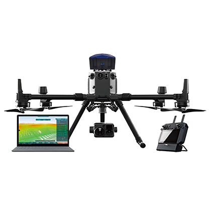
Overview:The USW-ZF19 airborne atmospheric environment remote monitoring system uses a non-fixed-wing intelligent UAV equipped with a high-resolution atmospheric environment monitoring analyzer, and adopts a wireless remote data transmission server.
The USW-ZF19 airborne remote monitoring system plays a vital role in the field of atmospheric environment monitoring operations and environmental emergency monitoring. The gaseous pollutant analysis system based on the UAV platform has the advantages of high operation efficiency, flexibility, convenient use and wide monitoring range, which provides a new technology platform and tool selection for atmospheric pollutant monitoring. In view of the concealment of air pollution emissions and the sudden nature of pollution incidents, it is difficult for traditional ground monitoring methods to meet the needs of environmental management departments. It has the advantages of monitoring, fast response, wide monitoring range and small terrain interference.
Unmanned Aerial Vehicle
With 360° obstacle avoidance and visual flight interface, it meets IP45 protection level; supports 55-minute long battery life and a maximum distance of 15 kilometers for image transmission; has automatic positioning and tracking function, even in the face of moving vehicles 600 meters away. , with real-time display of geographical location information; the wind resistance level reaches level 7; it has automatic flight planning, automatic return to failure, automatic landing without electricity, etc., black box function, automatic recording of flight data; carbon fiber and aviation aluminum materials, light and strong materials; The whole machine is foldable, convenient for transportation, and quick-release structure; flight data can be observed on the "Data" page of the ground station;
Multifunctional Infrared Imager
The multi-function infrared imager integrates a 20-megapixel zoom camera, a 12-megapixel wide-angle camera, a 30Hz high frame rate thermal imaging camera, and a laser rangefinder with a detection distance of 1,200 meters. Efficient switching between different screens. Users can select the target of interest on the wide-angle or infrared camera screen, and switch the zoom screen with one click to capture high-definition details. Turn on the night scene mode at night or in a dark light environment, and you will gain insight into the details of the dark parts.
Gas Analyzer
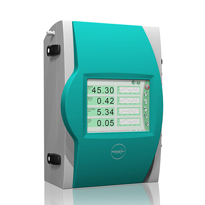
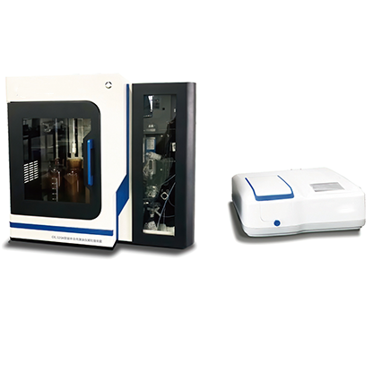
The airborne gas analyzer has nearly 50 kinds of gas components to be measured, including volatile organic compound gas, toxic and harmful gas, flammable and explosive gas, malodorous gas and particulate matter, etc., and can monitor no less than 18 kinds of substances at the same time. components. With its own meteorological monitoring module, the temperature, humidity and pressure in the environment are used as reference coefficients, and are brought into the calculation formula to carry out the environmental difference compensation algorithm to avoid the influence of environmental factors. The built-in pump suction sampler can preset the sampling flow rate to ensure a constant gas flow in the analyzer gas cell. The analyzer is placed above the UAV to avoid the airflow wind nest generated by the UAV's propellers from affecting the stability of the analyzer's monitoring data. The instrument adds local SD storage, and has the function of disconnecting and resuming transmission. Even if there is no network status monitoring blind area, it can monitor normally in the monitoring blind area. The analyzer is capable of quality control, and can use standard gas for gas quality control; and the instrument has undergone quantitative testing by national measurement units before leaving the factory.
Analysis Software Platform
The system platform can display the time change curve of air pollutant concentration and flight path concentration map in real time, generate the pollutant concentration distribution map in real time, and present the three-dimensional point cloud state map in real time. One-click export task report is supported. Raw data can be exported in Excel form. Seamless access to data such as air stations and fixed pollution sources for intelligent system observation, prediction, and traceability; monitoring, monitoring, trend analysis, situation management and statistical analysis management functions

 QR CODE
